What we do
Engineering & Construction
buried structures and foundations
abandoned utilities and infrastructure*
Cave and Sinkhole (Karst) mapping
Detection of voids with pavement, walls, floors, etc.
Detection of buried structures and foundations
Detection and mapping of abandoned and/or relict utilities and infrastructure*
Cave and Sinkhole (Karst) mapping
MUNICIPAL/INDUSTRIAL GROUNDWATER
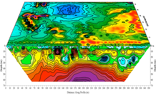
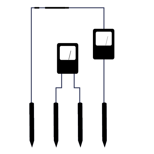
Aquifer detection and mapping
Bedrock fracture detection and tracing

ENVIRONMENTAL & COMPLIANCE
Underground storage tank (UST)
Contaminant plume mapping .
Subsurface characterizations
Geographic and scientific data processing, analysis and imaging


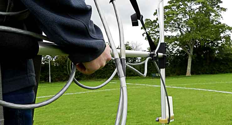
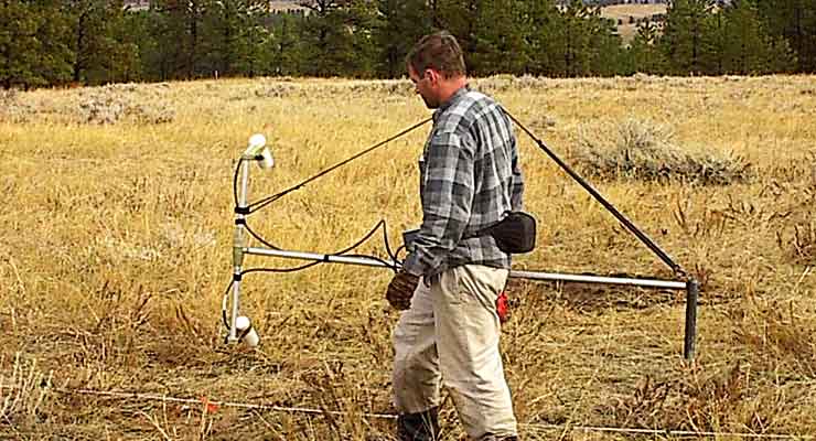
How we do it


We are proud to provide innovative geophysical solutions for engineering problems, environmental issues and compliance requirements.
Contact Us to Start a Project
Why Choose Us?
Experience
Reputation
We derive genuine personal satisfaction in delivering a quality product which our clients appreciate and value highly.
Value
Give us a call if you’re wondering if geophysics may beneficial to your project. We love talking about what we do!
We're qualified
We’re responsible
We're Savay
...
We are focused solely on providing quality geophysical services. Prism GeoImaging, Inc. does not compete with its clients by providing environmental or engineering consulting services.
We have expertise in using geophysics on a broad array of projects, from simple UST searches to large engineering projects and detailed studies of complex geologic features.

Over the years we have developed a reputation as knowledgeable and innovative geophysicists, gaining recognition from our clients, peers, and vendors.
We are committed to dealing ethically and with integrity toward our clients, vendors, colleagues.
We really enjoy the work we do, and derive genuine personal satisfaction in delivering a quality product which our clients appreciate and value highly.
Give us a call if you’re wondering if geophysics may beneficial to your project. We love talking about what we do!
Contact
Fishers, Indiana 46038-2331